Services We Offer:
Emergency Response Deployment:
Mission-Ready Tactical Support
Leveraging 15 years of emergency service experience and specialized FEMA training to provide critical situational awareness.
ICS Integrated Operations: We operate in full compliance with the National Incident Management System (NIMS). Our pilot is FEMA certified in ICS 100, 200, 700, and 800, ensuring seamless integration into the Command Staff and a deep understanding of the Unified Command structure.
Incident Command Overwatch: Providing real-time 4K aerial views of active scenes (Fire, MVA, Hazmat) to assist Incident Commanders in tactical decision-making and resource allocation.
Tactical Scene Reconnaissance: Rapid assessment of roof stability, structural integrity, or hazardous area viewing to mitigate risks before ground crews are deployed.
Search & Rescue (SAR) Assistance: Coordinated aerial support for wide-area searches or locating victims in the difficult terrain of Southeast Texas.
Post-Incident Documentation: High-resolution evidence and scene mapping for formal investigations, arson task forces, and agency after-action reviews.
Private & Commercial Services:
Professional Aerial Media & Infrastructure
High-definition 4K imagery and actionable data for Southeast Texas businesses and residents.
Real Estate Marketing: High-resolution exterior photography and cinematic "fly-around" video tours designed to make residential and commercial listings stand out in a competitive market.
Event Coverage: Comprehensive aerial documentation for private and public gatherings, including weddings, reunions, community festivals, and corporate milestones.
Construction & Site Monitoring: Scheduled aerial progress reports, including high-definition stills and site overviews, to assist developers in tracking timelines and ensuring site safety.
Infrastructure Inspection: Precision close-up imagery for roofs, towers, and hard-to-reach commercial assets, reducing the need for costly manual inspections and equipment.
Previous Deployments
Mission Spotlight: Major Rail Derailment Response
Date: April 20, 2026
Location: Old Sour Lake Road / Pine Island Bayou (Jefferson County, TX)
The Incident
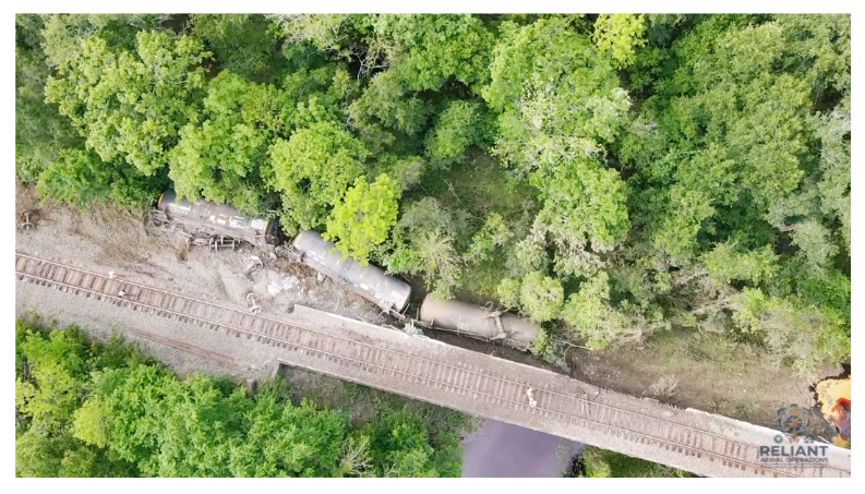
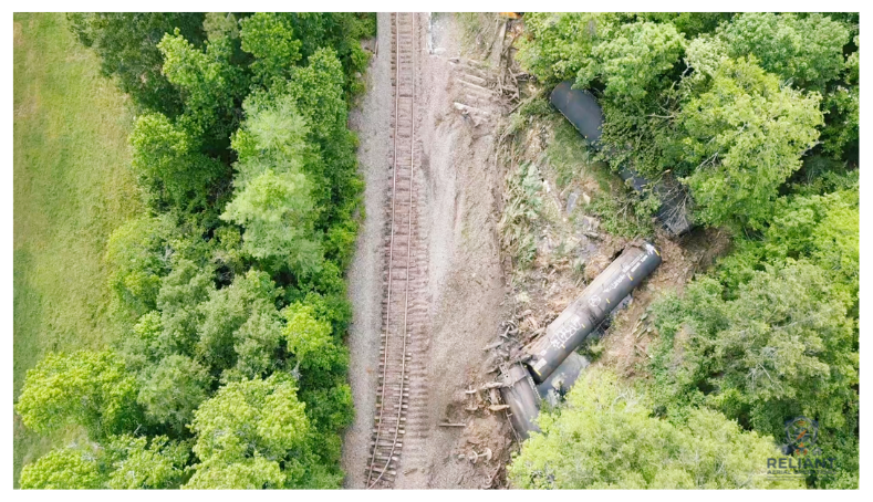
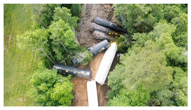
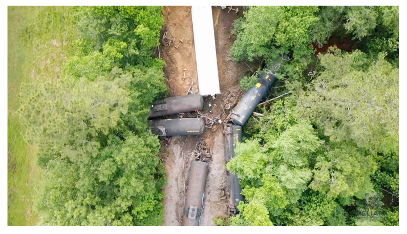
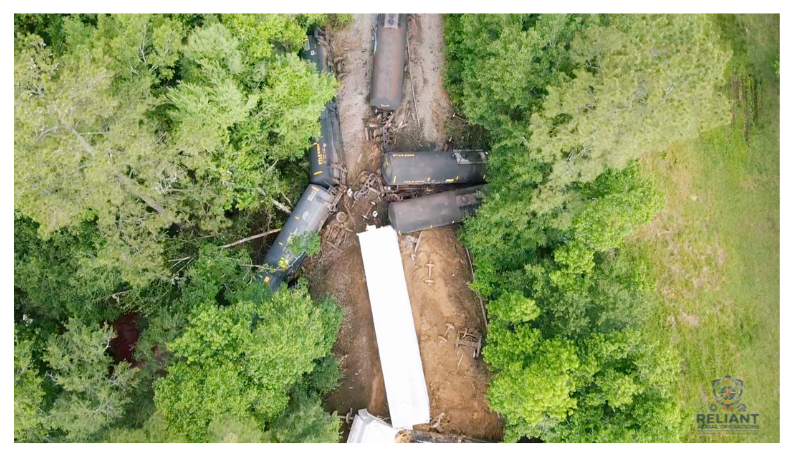
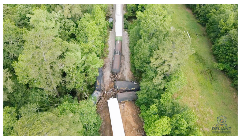
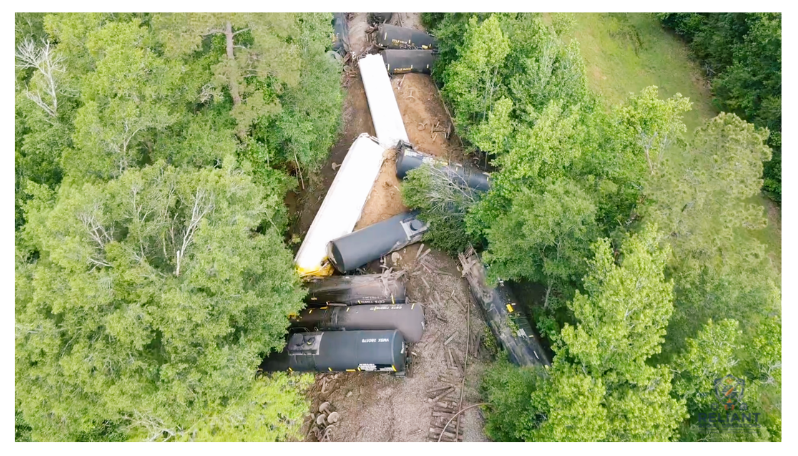
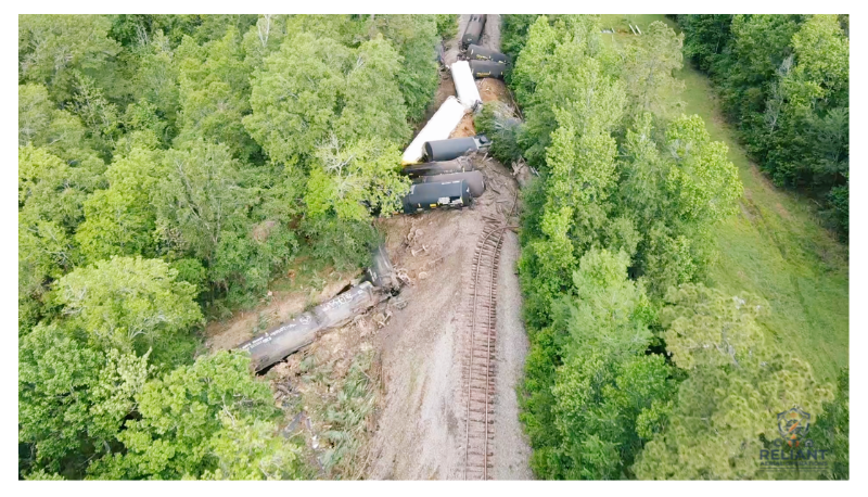
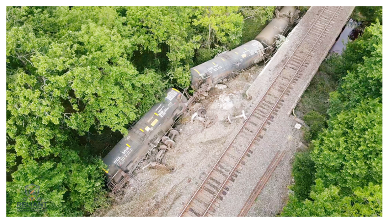
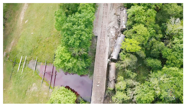
On the morning of April 20, a significant rail incident occurred approximately 1.8 miles west of Kolander Road. A total of 23 rail cars derailed, resulting in catastrophic damage to the rail infrastructure and the bridge spanning a cutout of the Pine Island Bayou. Several cars were partially submerged, and initial reports indicated a potential product release into the waterway.
The Response
Reliant Aerial Operations was deployed as part of the initial emergency response to provide immediate situational awareness. Leveraging our career experience in the fire service and emergency medicine, we integrated directly with the Jefferson County Sheriff’s Office, local Fire Departments, and Railroad Officials to conduct a comprehensive aerial scene size-up.
Our Impact
Tactical Reconnaissance: Delivered a bird’s-eye view of the wreckage, allowing Incident Command to safely identify the position and status of every derailed car.
Environmental Monitoring: Conducted high-resolution overwatch of the Bayou cutout to track product spread and identify potential release points.
Damage Assessment: Captured precision 4K imagery of the catastrophic rail and bridge failure to assist engineers and recovery crews in planning their approach.
Hazard Mitigation: Confirmed early in the operation that no hazardous materials were involved, significantly reducing the complexity of the response and ensuring the safety of the community.
The Result
Thanks to the rapid coordination between first responders and UAS support, the scene was stabilized with zero injuries reported. This mission highlights the critical role that "Mission-Ready" aerial intelligence plays in managing large-scale disasters in Southeast Texas.